Soil Survey of Dallas County, Texas Page: 7
This book is part of the collection entitled: Texas Soil Surveys and was provided to The Portal to Texas History by the UNT Libraries Government Documents Department.
Extracted Text
The following text was automatically extracted from the image on this page using optical character recognition software:
DALLAS COUNTY, TEXAS
Gowen
Axtell
Wilson
,,...Ancient alluvium
y alluvium
..Chalky limestone
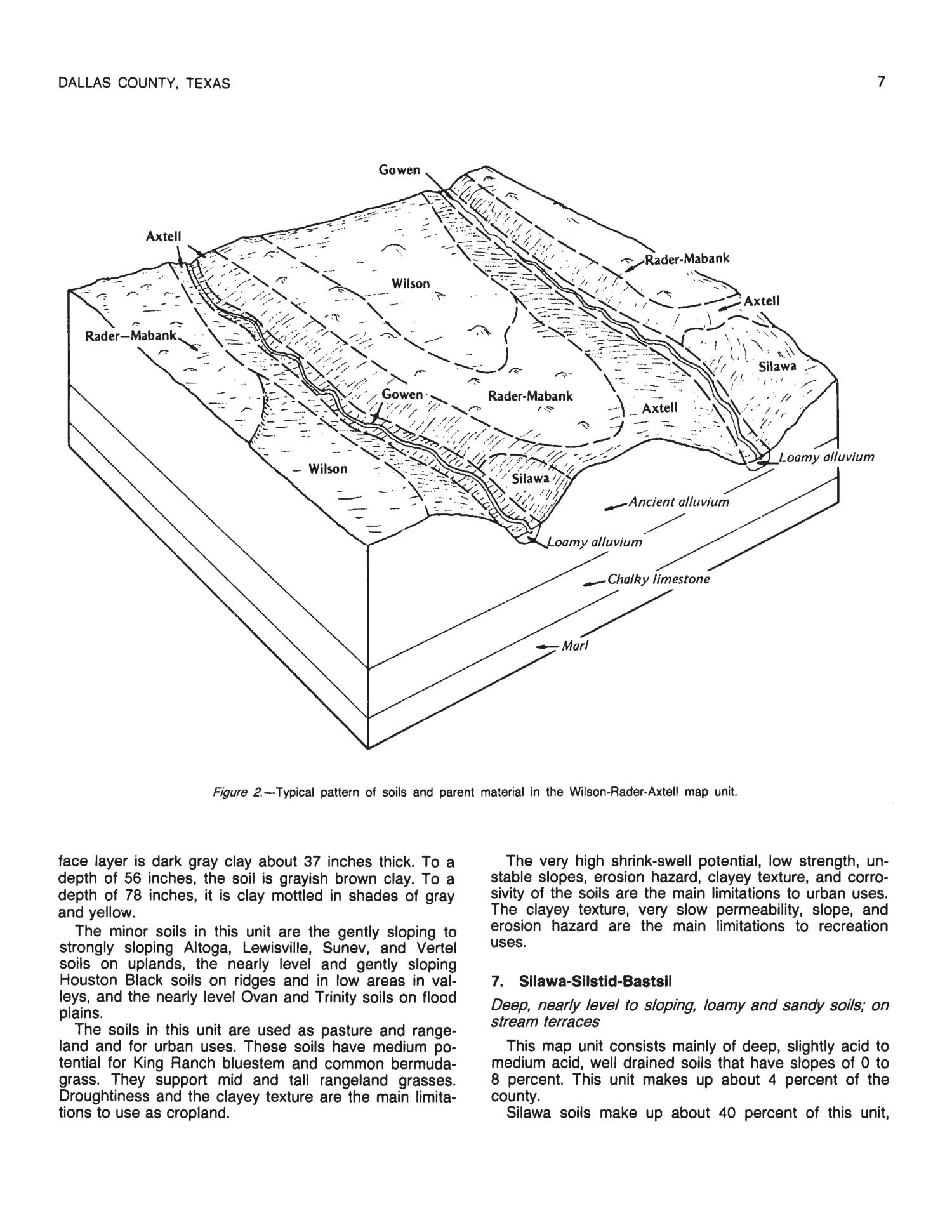
Figure 2.-Typical pattern of soils and parent material in the Wilson-Rader-Axtell map unit.
face layer is dark gray clay about 37 inches thick. To a
depth of 56 inches, the soil is grayish brown clay. To a
depth of 78 inches, it is clay mottled in shades of gray
and yellow.
The minor soils in this unit are the gently sloping to
strongly sloping Altoga, Lewisville, Sunev, and Vertel
soils on uplands, the nearly level and gently sloping
Houston Black soils on ridges and in low areas in val-
leys, and the nearly level Ovan and Trinity soils on flood
plains.
The soils in this unit are used as pasture and range-
land and for urban uses. These soils have medium po-
tential for King Ranch bluestem and common bermuda-
grass. They support mid and tall rangeland grasses.
Droughtiness and the clayey texture are the main limita-
tions to use as cropland.
The very high shrink-swell potential, low strength, un-
stable slopes, erosion hazard, clayey texture, and corro-
sivity of the soils are the main limitations to urban uses.
The clayey texture, very slow permeability, slope, and
erosion hazard are the main limitations to recreation
uses.
7. Sillawa-Silstid-Bastsll
Deep, nearly leve/ to sloping, loamy and sandy soils; on
stream terraces
This map unit consists mainly of deep, slightly acid to
medium acid, well drained soils that have slopes of 0 to
8 percent. This unit makes up about 4 percent of the
county.
Silawa soils make up about 40 percent of this unit,
Upcoming Pages
Here’s what’s next.
 18 of 238
19 of 238
20 of 238
21 of 238
18 of 238
19 of 238
20 of 238
21 of 238
Search Inside
This book can be searched. Note: Results may vary based on the legibility of text within the document.
Related Items
Other items on this site that are directly related to the current book.
General Soil Map, Dallas County, Texas (Map)
Map displays soil types along with creeks, towns, schools, churches, power transmission lines, oil and gas pipelines, roads, and railroads. Includes legend and symbols. Scale 1:253,400
Relationship to this item: (Has Part)
Tools / Downloads
Get a copy of this page or view the extracted text.
Citing and Sharing
Basic information for referencing this web page. We also provide extended guidance on usage rights, references, copying or embedding.
Reference the current page of this Book.
Coffee, Daniel R. Soil Survey of Dallas County, Texas, book, 1980; Washington D.C.. (https://texashistory.unt.edu/ark:/67531/metapth130211/m1/17/?rotate=0: accessed July 16, 2024), University of North Texas Libraries, The Portal to Texas History, https://texashistory.unt.edu; crediting UNT Libraries Government Documents Department.