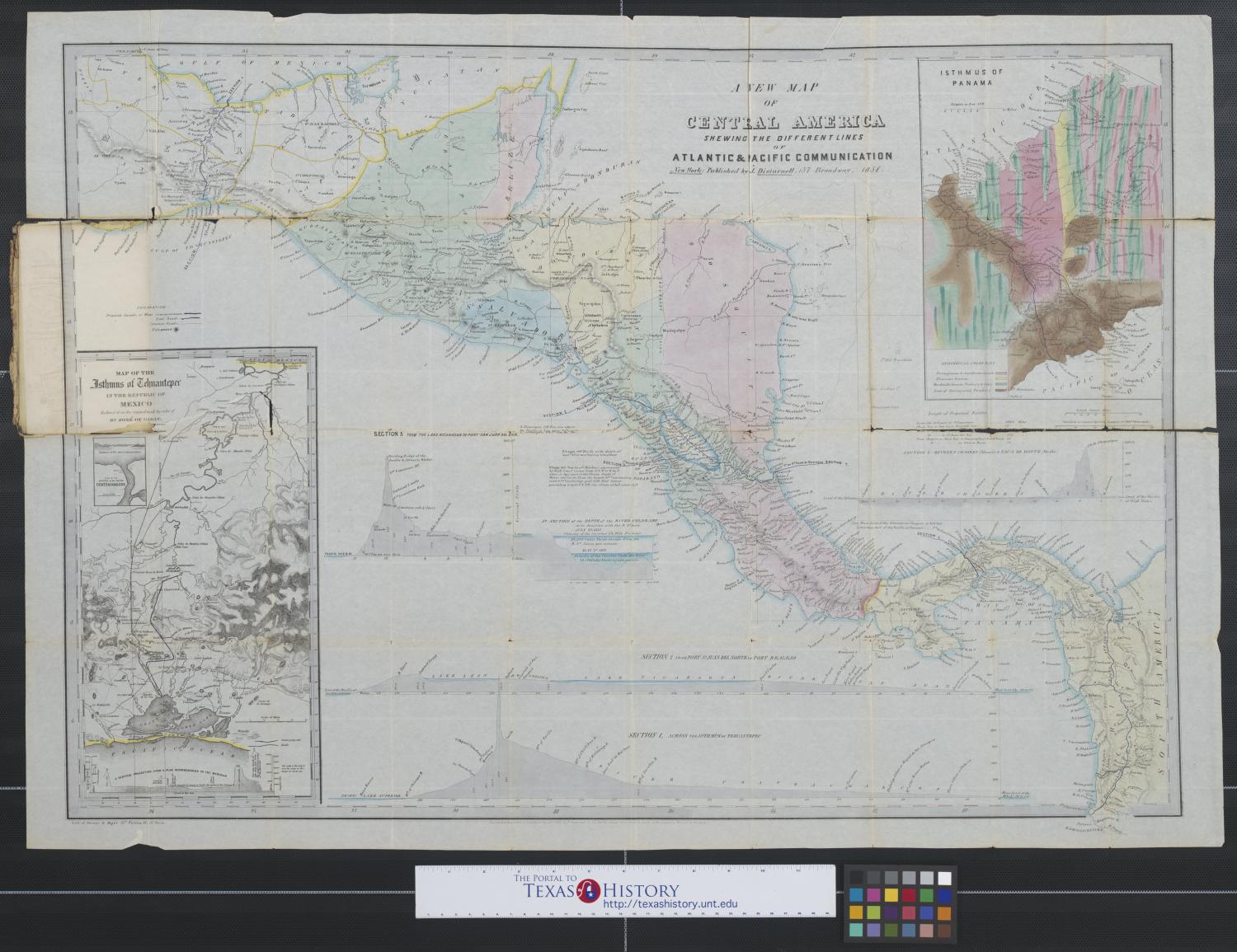
A new map of Central America shewing [sic.] the different lines of Atlantic and Pacific communication. Side: 1 of 2

Reference the current side of this Map.
A new map of Central America shewing [sic.] the different lines of Atlantic and Pacific communication., map, 1851; New York. (https://texashistory.unt.edu/ark:/67531/metapth193518/m1/1/?rotate=0: accessed July 16, 2024), University of North Texas Libraries, The Portal to Texas History, https://texashistory.unt.edu; crediting University of Texas at Arlington Library.